
Fishfinder · 3D depth maps
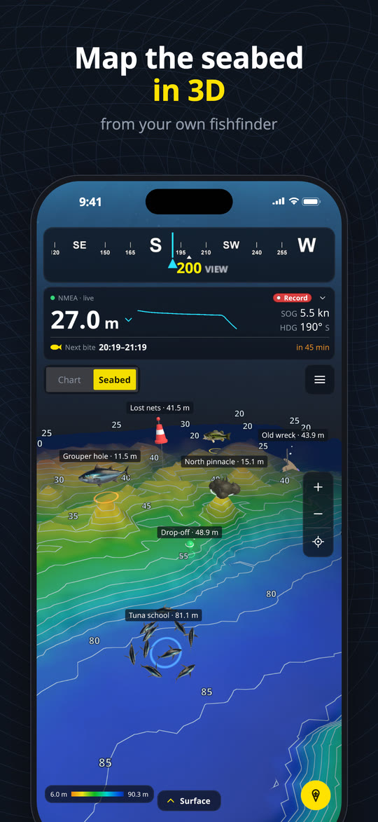
Map the seabed in 3D
from your own fishfinder
NMEA Mapper 3D reads depth and GPS from your boat over Wi-Fi and builds a private 3D map of the bottom as you drive. No extra sonar to buy, no subscription.
iPhone · iPad · Android
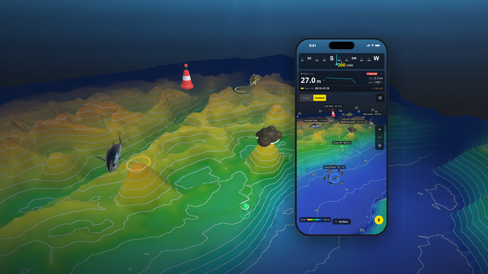
Everything you need on the water
From the first sounding to the spot you come back to next season.
Your own 3D depth maps
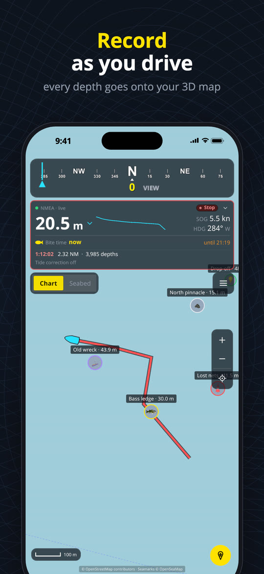
Press Record and watch the bottom take shape behind your boat. Tilt, turn and zoom over every ledge, drop-off, reef and wreck you pass.
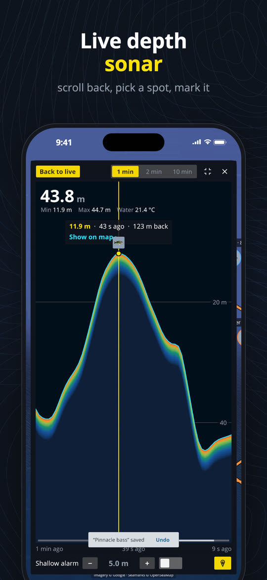
Live depth sonar
A fishfinder-style depth history over 1, 2 or 10 minutes. Scroll back, tap any moment to see where it was, and mark that spot.
Charts and seamarks
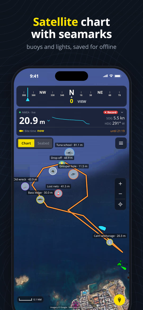
Street chart or satellite map with buoys, lights and harbour marks from OpenSeaMap. Areas you have viewed stay on your phone for use offline.
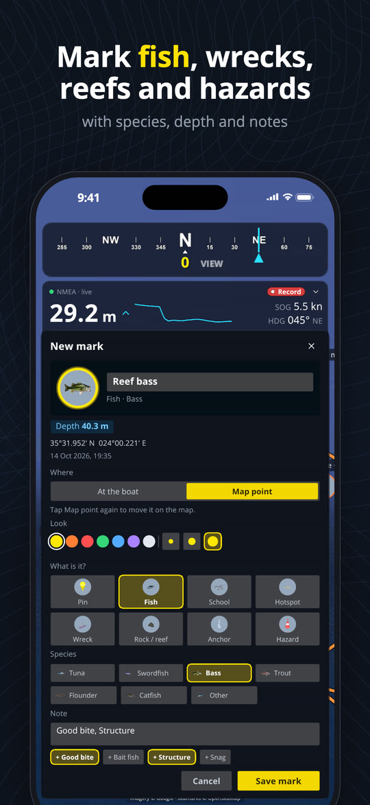
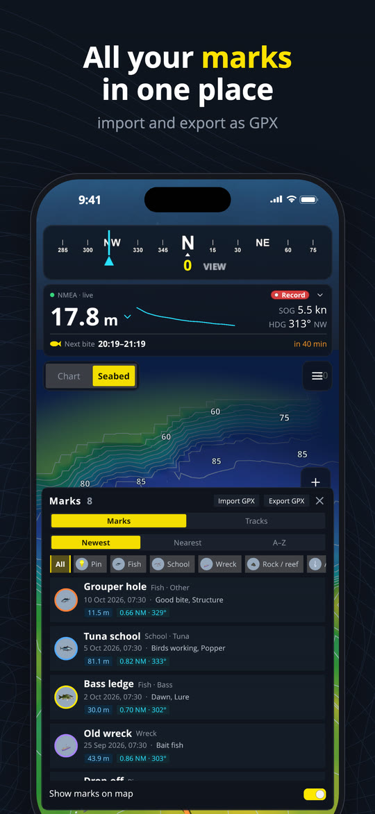
Mark your spots
Fish, schools, hotspots, wrecks, reefs, anchorages and hazards, with species, colour, notes and the depth. Import and export them as GPX.
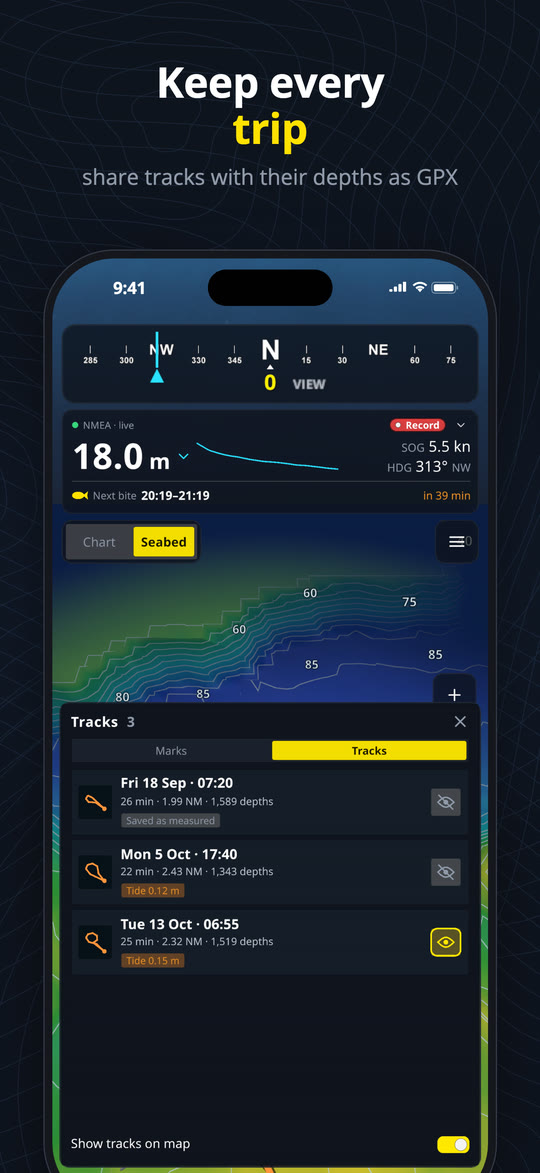
Every trip saved
Each recording becomes a track with its depths, distance and time. Dive into the 3D seabed from any point of it, or share it as GPX.
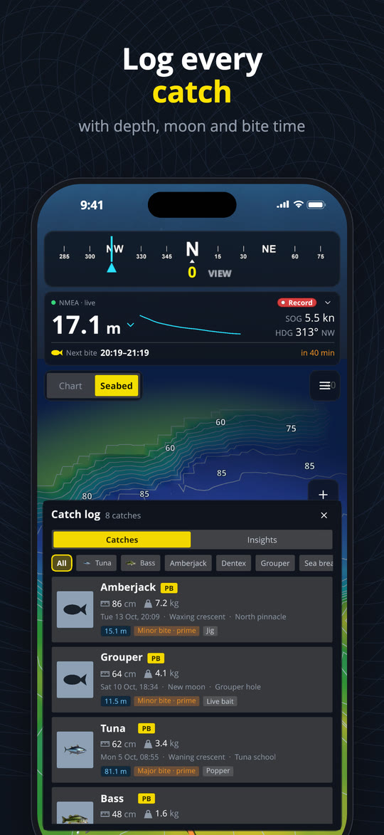
Catch log
Species, length, weight, bait and a photo in seconds. Depth, water temperature, moon and bite period are filled in, and Insights show what your best days share.
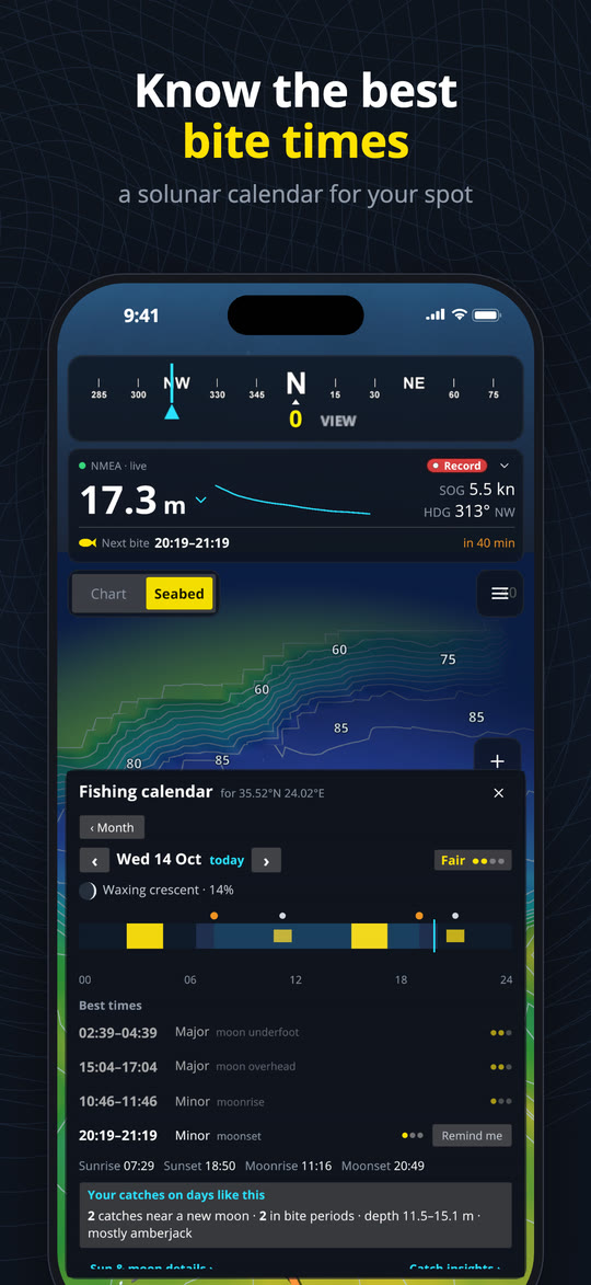
Bite times
A solunar calendar with major and minor bite periods for your spot, sun and moon times, and a reminder before the next bite.
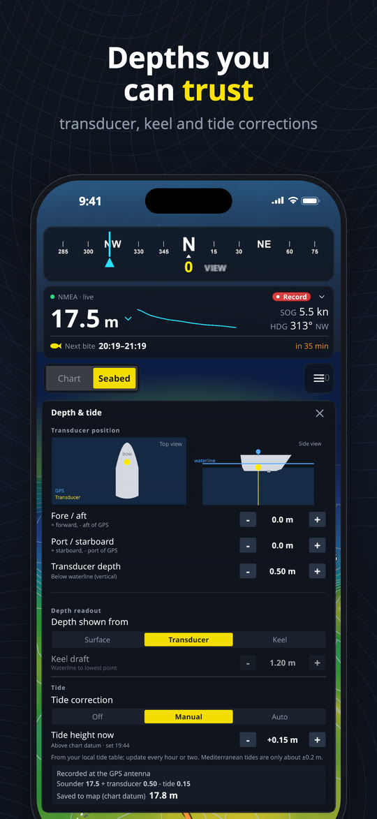
Depths you can trust
Transducer depth and keel offset, depth from the surface, transducer or keel, and tide correction from nearby tide stations or set by hand.
Works with your boat
Connects to a Wi-Fi gateway, multiplexer, chartplotter or fishfinder with NMEA 0183 over TCP or UDP, and finds it automatically.
See it in action
On iPhone and iPad. Swipe to see more.
Learn it in minutes
The User Guide takes you from connecting your boat and recording your first depths to the sonar, marks, catch log and bite times.
- Quick start in five steps
- Connecting to your boat’s NMEA over Wi-Fi
- Tips and answers to common questions
Your data stays yours
NMEA Mapper 3D needs no account. Your depth maps, marks, tracks and catches are stored on your device, never on our servers.
- No sign-up and no data selling
- Your depth maps never leave your phone
- Usage statistics only if you allow them
Get NMEA Mapper 3D
For iPhone, iPad and Android. Free to use.